The water the Southwest prayed for came all at once: what two weeks of floods did to the Four Corners, to Arizona, to the drought, and to the Colorado River

On October 13 the U.S. Drought Monitor showed every acre of Archuleta County in drought. Two weeks later it showed none of it. In between, the San Juan Mountains took two storms that between them put the Piedra River, the Mancos River and a half-dozen Arizona rivers at or near the highest flows anyone has measured, sent more water into Lake Powell in a single October than in any October but one since Glen Canyon Dam closed, and left two states asking the president for disaster declarations and a third declaring its own emergency. The last of the rain fell Monday morning. By Tuesday morning, Election Day, the sky over the whole region was clear, the rivers were falling, and the accounting had begun.
Two storms, one saturated mountain range
The first storm was the remains of Pacific hurricane Trudy, which stalled over the San Juans October 21 to 24 and dropped more than 4 inches on Wolf Creek Pass and the Conejos headwaters. The second was an atmospheric river that arrived Saturday night, October 31, on ground that had never dried. The Natural Resources Conservation Service's snow survey station at Wolf Creek Summit recorded 4.8 inches of precipitation between late Saturday night and 2 a.m. Monday, most of it rain. Durango's airport measured 2.92 inches over the four days, Cortez 2.17. Since October 1, Durango has recorded 6.93 inches of precipitation against a normal of 1.5, Cortez 6.98 against 1.12, and Alamosa 3.84 against 0.68.
The rivers responded as if the second storm were the larger one. The Piedra near Arboles, whose record before this fall was 8,370 cubic feet per second, ran 17,000 on October 23 and 17,800 Sunday night. The Mancos near Towaoc, measured since 1921, reached 5,490 cubic feet per second at 1 a.m. Tuesday, past the 5,300 of October 1941, and was still near that level at last report. The San Juan at Pagosa Springs reached 16.8 feet Sunday evening, the second highest stage since 1911 and a foot below that flood, before the forecast of 22 feet, which would have been the highest water in the town's history, failed to arrive. The Animas at Durango peaked at 13,000 cubic feet per second at 10:45 a.m. Monday, the third highest since 1898 and the highest since 1927. The Dolores at Dolores came within 500 cubic feet per second of its 1911 record. East of the divide the Rio Grande near Del Norte reached 10,900 cubic feet per second Monday morning on the state's gauge, matching its October 23 peak and the third highest flow in records that go back to 1890, and the South Fork and the Conejos both topped their flows of two weeks earlier.
Downstream the water kept climbing into Tuesday. The San Juan at Farmington reached 23,900 cubic feet per second Monday afternoon, the Animas at Farmington 11,000, which the National Weather Service said was "approaching those experienced during the great flood of October 1911." The San Juan at Shiprock was at 22,700 and the river at Bluff, Utah, at 28,800 at 1 a.m. Tuesday, both at or near their crests. All of these figures are provisional and several gauges stopped reporting at the height of the flood.
What it cost
In Colorado, Governor Jared Polis asked the president Saturday for a major disaster declaration for Archuleta and Rio Grande counties from the first flood, with 26.989 million dollars in public damage already counted and about 100 homes in Archuleta County still unreachable. That request now describes the smaller of the two floods. The Colorado Sun reported Monday that a house on San Juan Street in Pagosa Springs fell into the river before noon, that the town's history museum was teetering on an eroded bank, and that a severed fiber line had left the town without cellphone service. In Durango, Junction Creek flooded a hotel and homes on Alamo Drive, a nursing home was evacuated through its back doors, and five mobile home parks were ordered out Sunday night. U.S. 160 closed from east of Bayfield to Pagosa Springs at 2 p.m. Sunday, Colorado 151 collapsed again in the same stretch that washed out in October, and Colorado 41 closed at the Four Corners. The Federal Highway Administration had released 6.5 million dollars Friday toward an estimated 65 million in highway damage from the first flood alone.

Election Day went on. Archuleta County closed the Ross Aragon Community Center voting center and opened two others, at the courthouse and the Pine River Library in Bayfield, and La Plata County sent bipartisan teams of election judges to deliver ballots to people in shelters. Ballots were due at 7 p.m. Tuesday.
New Mexico's governor, Michelle Lujan Grisham, asked Monday for a major disaster declaration for the October 22 to 30 flooding, listing 604 homes damaged or destroyed so far, a figure the state expects to reach 2,000, more than 5,000 people ordered out of their homes in San Juan County, 190 people still in the Red Cross shelter at McGee Park in Farmington, more than 40 million dollars in road and bridge damage, nearly 42 million in agricultural losses, and total damage expected to pass 200 million. The state has signed 73 emergency orders and committed more than 54 million dollars of its own money. The federal emergency declaration granted the week of the first flood brought agency help but no reimbursement, the release said. That count was made before the second flood, which put the La Plata River into houses at the junction of New Mexico 574 and 170 Monday morning and sent the Animas through a brick wall into Boyd Park in Farmington.
Arizona's turn
The same atmospheric river crossed Arizona first, and Arizona's rivers, which drain to the Gila rather than the Colorado's upper basin, had their own historic weekend. The weather service's Flagstaff office tallied 7.54 inches at Crown King, 6.70 at the Village of Oak Creek, 6.60 at Forest Lakes, 6.17 at Munds Park, 5.87 at McNary and 5.61 at the Prescott courthouse. Flagstaff's airport recorded 3.37 inches on Sunday alone and 9.65 inches since October 1, six times normal.
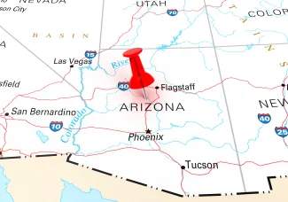
The Salt River near Roosevelt reached 143,000 cubic feet per second at 2 a.m. Monday, equal to the record set in January 1993, and the weather service's gauge put the stage half a foot above the 1993 flood of record. The Verde River below Tangle Creek ran 120,000, the third highest since 1891. Oak Creek at Sedona came within 600 cubic feet per second of its 1993 record, Tonto Creek passed 56,000 before its gauge stopped reporting, and the Little Colorado at Winslow was above the 25-foot level at which the weather service says the town's levee is overtopped, with a crest of nearly 40 feet forecast for Tuesday morning. Two men were found dead in Flagstaff floodwaters Monday morning, Arizona news outlets reported, and the Flagstaff office counted 150 to 200 homes flooded at Rimrock and Lake Montezuma and about 100 properties at Munds Park. Governor Katie Hobbs declared a statewide emergency Monday for parts of Apache, Coconino, Gila, Greenlee, Navajo, Pinal and Yavapai counties and five tribal nations, releasing 200,000 dollars in state emergency funds.
© iStock - ventdusud
The Salt River Project, which runs the dams above Phoenix, reported Tuesday that Roosevelt Lake had taken in 194,839 acre-feet in a single day and that its six reservoirs together held 1.44 million acre-feet, 63 percent of capacity, against 54 percent a year ago. The two Verde dams were nearly full. SRP was releasing more than 51,000 cubic feet per second from Bartlett Dam and warned that flows of more than 60,000 would run down the normally dry Salt River bed through the Phoenix area, closing riverbed roads and Tempe Town Lake.
The drought map, before the second storm
The Drought Monitor released October 29 reflects conditions through the morning of October 27, after the first flood and before the second. It showed 34.9 percent of Colorado free of drought, up from 16.5 percent a week earlier and 8.9 percent at the end of September. Severe drought or worse fell to 28.5 percent of the state from 58.2 percent on September 29, and exceptional drought to 4.3 percent from 10 percent. Archuleta, San Juan and Kiowa counties were entirely clear. Mineral County was 95 percent clear, La Plata 90, Dolores 89, Montezuma 60, Rio Grande 50, Conejos 25. Two weeks earlier, Rio Grande and Conejos counties were about 90 percent in severe drought or worse. The Press's account of that map is online.
Arizona moved the same direction. Drought-free ground went from 9.7 percent of the state in mid-October to 31.1 percent, and moderate drought or worse from 46.4 percent to 33.6. New Mexico's severe-or-worse area fell by more than half in four weeks, to 21.5 percent, while Utah, which the first storm largely missed, still had 91 percent of its land in at least moderate drought. The map that comes out Thursday will be the first to include this weekend, and the authors will have to decide what to do with a part of the country where the ground is saturated, the reservoirs are rising, and the long-term deficit of two decades is still on the books.
The river
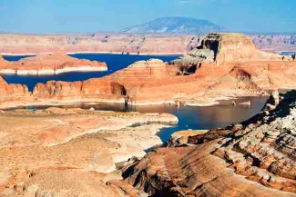
Lake Powell took in 1.28 million acre-feet in October, according to the Bureau of Reclamation's daily records. In the 64 Octobers since the dam closed, only October 2006 brought more, and the October average is 566,000. More than 770,000 acre-feet of that arrived in the last ten days of the month. The lake rose from 3,518 feet on October 1 to 3,532 on November 1, 16 feet above the record low it set September 15, and from 5.17 million acre-feet in storage to 5.98 million, 26 percent of capacity. Inflow on November 1 alone was 23,900 cubic feet per second, nearly four times the release, and the second flood had not yet reached the lake.
Navajo Reservoir on the San Juan, the first big dam below all of this, did something stranger. It held 830,000 acre-feet on October 1, 50 percent full. On November 1 it held 1.22 million, 72 percent, after a single day's inflow of 27,700 cubic feet per second, with releases held at 250. The reservoir caught 359,000 acre-feet in October, more than the previous ten Octobers combined and the most for any October since Reclamation's daily record begins in 1980. Lake Mead, 500 miles downstream, barely noticed: it gained about a foot of elevation in October, because Powell is holding the water and releasing on schedule. The Press's October 29 report on the lakes explains why that matters, and Reclamation's November study, due November 13, will say how much of this water changes next year's operations.
What comes next
The forecast is dry. The Grand Junction, Pueblo, Flagstaff and Phoenix offices all expect clear skies into the weekend, with a weak system brushing Colorado Wednesday. The Flagstaff office put it plainly Tuesday morning: "Despite the dry forecast, serious flooding continues in spots." The San Juan's crest reaches Bluff Tuesday, the Salt River's release runs through Phoenix all week, and the Rio Grande's water moves through the San Luis Valley toward Alamosa through Wednesday. Road conditions are at cotrip.org, nmroads.com and az511.gov. The Press's reports on the first flood and the second are online.